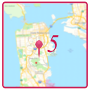
GeoTag is a free macOS application that allows you to update image metadata with geolocation tags by panning and zooming in a map window and then clicking on the location where a photo was taken. It is a good way to add location information to photos or fine tune existing location information.
Image file updates are performed using Phil Harvey’s ExifTool. This allows geolocation data to be modified an unlimited number of times with no image degradation as ExifTool modifies metadata without changing the image data. See https://exiftool.org for information regarding ExifTool.
GeoTag 5.3 and later can also update geolocation information in images from your Photos Library. Apple’s Photos framework is used instead of ExifTool for such updates. The original image file is not changed.
GeoTag Version 5.3.1
2024-06-14 — GeoTag 5.3.1 available in the Mac App Store
2024-06-14 — GeoTag 5.3.1 available from this site (dmg file)
GeoTag Version 5 Operating Instructions
GeoTag 5.3.1 requires macOS Sonoma (14) or later.
Use Version 5.1 if you are running Ventura (13).
Use Version 4.15 if you are running an earlier version
of macOS.
There is a map pin location issue when running on early versions of macOS Sonoma. If you see a pin placed above the point you clicked/tapped you are seeing this bug. Apple fixed the issue in version 14.4 (or perhaps it was 14.4.1). It is not a problem in the current version of Sonoma.
App Store Link
The same (free) app that is available via the following download link is also available in the Mac App Store. Get the app whichever way you like. App compiled for both intel and Apple Silicon Macs.
Download link
Version 5.3.1 download Requires macOS 14 or later. The file is about 8.5 MB in size. Open the dmg file. Drag the GeoTag application into your Applications folder.
Updated in 5.3.1
- Hitting the return key after entering text in the map search field will automatically select the first search result and position the map at that location.
- ExifTool version 12.87
Bugs Fixed in 5.3
- Bug fix: locations selected by clicking on map are applied to all selected images, not only the most selected item.
- Bug fix: recenter map when pasting lat/lon into selected item
- Bug fix: Apply search results locations to any selected images and zoom into the location when necessary.
- Bug fix: Don’t attempt to update the GPS timestamp when the image does not have timestamps.
- Bug fix: Don’t limit map search result to address types as that hid otherwise valid search results.
- Bug fix: allow location updates to PNG files again. Whatever limitation that caused support to be removed in 2020 no longer applies.
Issues
- undo/redo menu items are always enabled, even when there are no undo or redo actions that could be performed. The menu titles are also not updated for the action to be performed.
- There is a short delay between clicking on the map and a map pin being placed.
- When showing pins for all selected locations the red (most selected) pin may be hidden by the pin of another location near by unless the zoom level is such that both locations are slightly separated on the map.
- when changing the selection to an image that has a location some of the pin may off the map view. In an extreme case only the point of the pin is on the map and can not be seen. If you do not see a pin when you expect to zoom out slightly.
- Sometimes ⌘Z (undo) appears to do nothing, requiring a second invocation to perform the undo action.
- paste sometimes not enabled after cut. Can not reproduce on demand.
History
A change log for earlier versions can be found on the history page.
GeoTag source code is available on github [link]
Don’t see a feature you want? Know how to code? Grab the code and dig in.
Please use the GeoTag Help -> Report a bug... menu item to report bugs,
ask for new features, or make other comments.